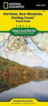
Harriman, Bear Mountain, Sterling Forest State Parks (National Geographic Trails Illustrated Map)
National Geographic Maps
Synopsis "Harriman, Bear Mountain, Sterling Forest State Parks (National Geographic Trails Illustrated Map)"
- Waterproof - Tear-Resistant - Topographic MapAt over 46,000 acres, Harriman State Park is the second largest state park in New York and is located only 30 miles north of New York City. It is a haven for hikers with over 200 miles of trails, and water-sport enthusiasts flock to its three beaches and 31 lakes and reservoirs. On the northeastern edge, the park borders the 5,067-acre Bear Mountain State Park which offers a variety of year-round outdoor activities. Sterling Forest State Park borders Harriman on the southwest. This nearly 22,000-acre forest habitat is important to the survival of many resident and migratory species, including black bear, a variety of hawks and songbirds and many rare invertebrates and plants. National Geographic's Trails Illustrated map of Harriman, Bear Mountain, and Sterling Forest State Parks provides unmatched detail of these parks to meet the needs of casual park visitors and avid adventurers alike. Expertly researched and created in partnership with local land management agencies, this map features key points of interest including Greenwood, Tuxedo, and Sterling lakes; Stony Point Battlefield and Fort Montgomery state historic sites; Hudson River; Haverstraw Bay; High Tor State Park; and Ramapo River.The Appalachian Trail, Long Path Trail, and other national recreational trails wind through the region. Each trail is clearly indicated as is trail mileage, park and forest boundaries, parking areas, and access points. A handy trail chart will help you choose the right path for your use, whether hiking, horseback riding, cross-country skiing, or biking. The map base includes contour lines and elevations for summits, passes and many lakes. Campers will appreciate the inclusion of RV dump stations, group campsites, shelters, restrooms, and more. Activities abound in the region and the location of scenic overlooks, lookout towers, downhill ski areas, boat rentals, fishing access points, and other points of interest make this map as highly functional as it is remarkably crafted. Every Trails Illustrated map is printed on "Backcountry Tough" waterproof, tear-resistant paper. A full UTM grid is printed on the map to aid with GPS navigation.Other features found on this map include: Haverstraw, Kiryas Joel, Peekskill, Ramapo, Stony Point, West Haverstraw.Map Scale = 1:30,000Sheet Size = 37.75" x 25.5"Folded Size = 4.25" x 9.25"