Tracked shipping to Austria with premium packaging for just 3,99 € 

Ship to
Austria
0
  • argentina
  • chile
  • colombia
  • españa
  • méxico
  • perú
  • estados unidos
  • internacional

Select your country

Americas

Europe

Rest of the world

portada Great Smoky Mountains National Park day Hikes map
Type
Physical Book
Language
English
Format
Paperback
ISBN13
9781566958011
Edition No.
2023

Great Smoky Mountains National Park day Hikes map

National Geographic Maps (Author) · National Geographic Maps, · Paperback

Great Smoky Mountains National Park day Hikes map - National Geographic Maps

New Book Imported to Austria
Delivery: 22 Jul - 27 Jul Shipping: 2 to 4 business days.
19,02 €
Import costs and 10% VAT included in the price ✅
19,02 €

Synopsis "Great Smoky Mountains National Park day Hikes map"

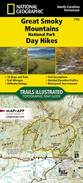
- Waterproof - Tear-Resistant - Topographic MapThe Great Smoky Mountains are named for their thick morning fog, and Great Smoky Mountains National Park is known for its abundant biodiversity, its magnificent waterfalls and its strong southern Appalachian mountain culture. The park is home to over 850 miles of hiking trails meandering up and over ancient mountains ranging from 875-foot valleys to 6,643-foot peaks.The Great Smoky Mountains National Park Day Hikes Topographic Map Guide includes eighteen diverse hikes for all outdoor enthusiasts, from the easy, 3.5-mile Andrews Bald Trail to the strenuous, 11.5-mile Lakeshore-Shuckstack Loop. Each hike has a detailed map, a trail profile visualizing the changes in elevation, and a short summary of the interesting features encountered along the trip.Some of the must-visit sites in this Topographic Map Guide are: Rainbow Falls--the highest single-drop waterfall in the Smokies, Chimney Tops--one of only a few peaks in the Smokies with bare rock summits, and Meigs Creek Trail--which crosses the creek almost twenty times without bridges and passes the 18-foot Upper Meigs Falls.More convenient and easier to use than folded maps, but just as compact and lightweight, National Geographic's Topographic Map Guide booklets are printed on "Backcountry Tough" waterproof, tear-resistant paper with stainless steel staples. A full UTM grid is printed on the map to aid with GPS navigation.Map Scale = 1:50,000Folded Size = 4.25" x 9.38"

Customers reviews

Frequently Asked Questions about the Book

All books in our catalog are Original.
The book is written in English.
The binding of this edition is Paperback.

Questions and Answers about the Book

Do you have a question about the book? Login to be able to add your own question.

Opinions about Bookdelivery

More customer reviews